

The Pacific has been giving us a little bit of drama this week, and Genevieve has definitely earned her spot in the storm spotlight.
After a brief encore performance as a Category 4 hurricane, Genevieve is now steadily weakening as she moves west-northwest into a much less supportive environment.

The behind-the-scenes meteorology team has been watching the same story unfold:
🌊 Cooler ocean temperatures = less fuel for the storm
🌬️ Increasing wind shear = a tougher environment to maintain structure
💨 Dry air = slowly getting into the circulation and disrupting the engine
As of the latest update, Genevieve is a tropical storm with maximum sustained winds near 65 mph. She is moving quickly west-northwest over the open Pacific, far from land impacts.

The forecast calls for continued weakening, with Genevieve expected to lose tropical characteristics and eventually become a remnant low.
But the producer in me has to give her credit… she was a fascinating storm to watch. She weakened, surprised everyone with another Category 4 chapter, went through an eyewall replacement cycle, and held together longer than some expected.
Not every storm has a big finale. Some just slowly fade out over the open ocean — but the science happening behind the scenes is still pretty amazing.
🎬 And now… we may be heading into a brief intermission while the Pacific resets.

(Yes, I’m still keeping an eye on the tropics. The producer never really leaves the control room. 😉)

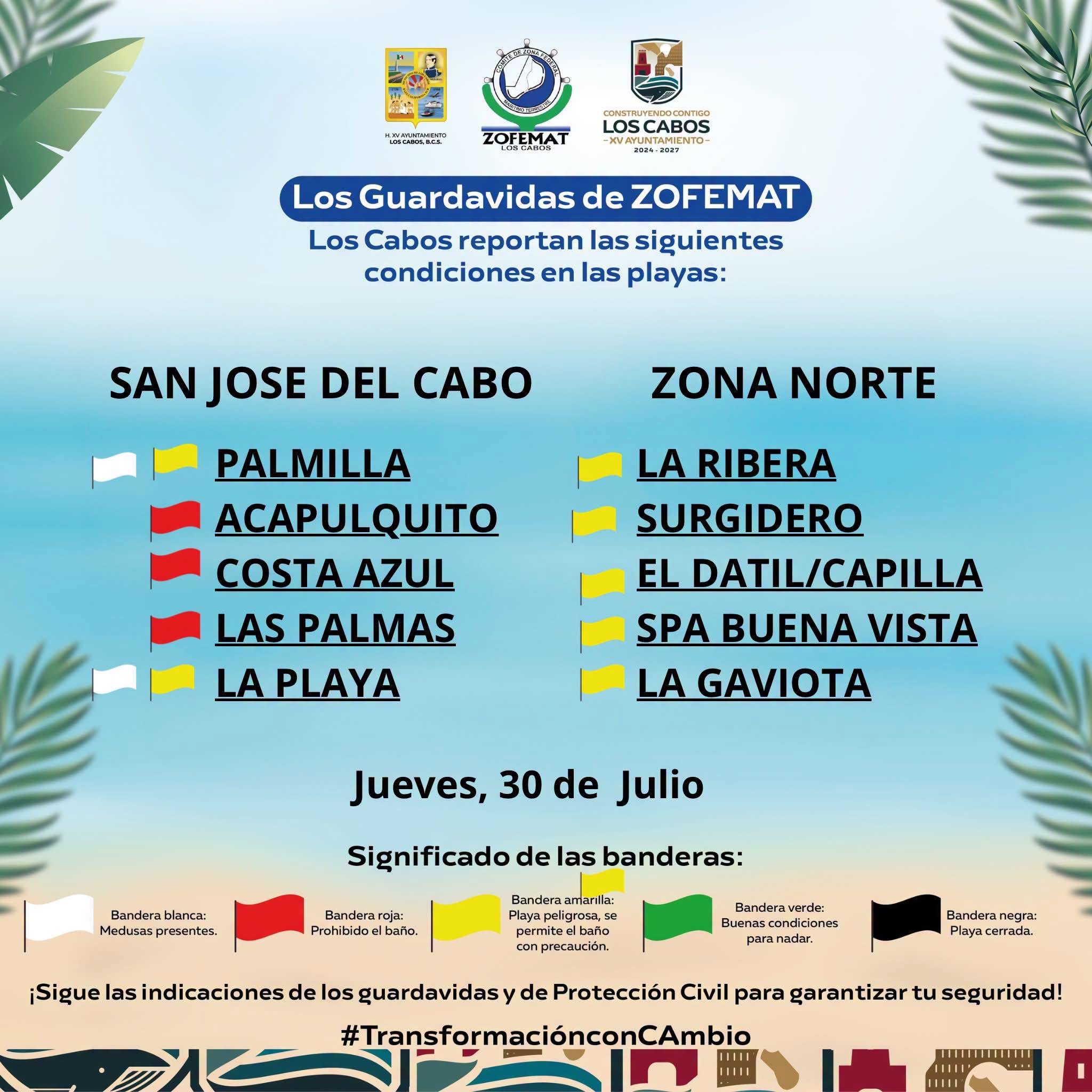
Yes – Those ARE yesterday’s beach flags. Today’s have not been issued yet, but RED MEANS 🛑 do not go in the water! #beachsafety White flags? Jellyfish! OUCH!!!!

#HurricaneGenevieve #TropicalStormGenevieve #PacificHurricaneSeason #EasternPacific #CentralPacific #TropicalWeather #HurricaneUpdate #WeatherWatching #StormTracking #Meteorology #WeatherScience #NHC #HurricaneSeason2026 #cabosanlucas