
Of course there is a breeze but … we are still working on installation 😊 so measurements are iffy today. Borrowing the neighbors stats for a sneak peak of what we will be reporting from down by the marina! Pedregal’s Weather Station is over 400 feet above sea level whereas our will only be 40-55 feet above sea level so it’ll be interesting to see what if any differences we report. Also, not knowing which weather station model they use, our stats may be different.


Click to to see the source of images below
Along with the following exact quote from a professional and educated meteorologist:
ZCZC MIATWOEP ALL
TTAA00 KNHC DDHHMM

TROPICAL WEATHER OUTLOOK
NWS NATIONAL HURRICANE CENTER MIAMI FL
500 AM PDT THU JUN 16 2016

For the eastern North Pacific...east of 140 degrees west longitude:

1. Showers and thunderstorms associated with a broad area of low
pressure located a few hundred miles south-southwest of Manzanillo,
Mexico have changed little in organization since yesterday.
Environmental conditions appear to be conducive for some gradual
development of this system over the next couple of days, and a
tropical depression could form during the next day or two while the
disturbance moves west-northwestward at 5 to 10 mph.  Over the
weekend, however, conditions are forecast to become less conducive
for tropical cyclone formation.
* Formation chance through 48 hours...medium...60 percent
* Formation chance through 5 days...medium...60 percent

Forecaster Cangialosi

Next image will have an orange X which is where the center of Invest 93e is located, and the shading shows where the computer models think this low pressure system may go.

Click HERE for link to images below


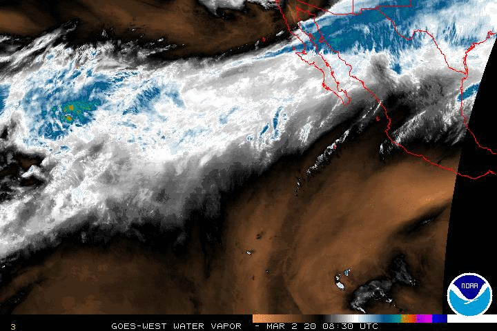
If you are still “with me” … yeah, it looks like if this thing could potentially throw off a few rain clouds our way so lets look at the current animated GIF of Water Vapor imaging
http://www.ssd.noaa.gov/goes/west/epac/wv-animated.gif
As always, I enjoy putting together the info from various sites and I do so for free. Why am I bringing this up? It is important to me, that anyone the follows this blog or my updates on FB understand this is something I enjoy doing. Call it a hobby, but I really want people to learn as I learn. Many arm-chair meteorologists are out there. Some of us keep it short and to the point, some of us make long drawn out observations and predict the weather month(s) in advance. One thing I will always do, is to give credit to the source of my information including quoting them and linking back – plagiarism does NOT happen on this blog. I look at what the NHC puts out as well as several government sites and often add off color personal remarks. I find it helps calm my own nerves – call me self centered. I am tickled pink like my hair sometimes is (on accident) that we have our own weather station after nearly two years of research on what would work best for our needs.
Also, thank you to everyone that have been enjoying my reporting of my immediate weather for the last few years. I know most prefer the FB version, would you prefer I do both? I don’t mind … leave a comment below and let me now.
Have a blessed day filled with sunshine, health, love and happiness.
Now today, I am being too wordy. #sorrynotsorry ~ Jenn