
Afternoon text edit/update/babble: The National Hurricane Center kept to it’s word and has stopped speaking about CELIA though wunderground still shows her path, not that there is much left. 35mph max speeds. Break ups are so hard. DARBY has increased in max sustained wind speeds just a tad – 5mph, and is maintaining forward motion at 9mph … DARBY is now 35 miles FURTHER away from us. There really hasn’t been any change in Tropical Depression SIX-E and the NHC thinks sometime tonight or tomorrow it will finally get it’s name (Estelle) as our 5th Tropical Storm of the season and then maybe our 3rd Hurricane. Long term forecasts show favorable conditions for this development to occur but in the wake up first Celia and then Darby, it’s possible it won’t develop further. Several days ago, Dr. Jeff Masters seemed pretty sure Estelle would develop so … we’ll see. Do not be surprised if we see a storm pop up one after another in the ocean for the next few weeks like the newest low pressure system that currently has a 20% chance of development in the next 5 days. The East Pacific had a late start and seems like it has a point to prove but as long as the storms avoid land, then it will be a pleasure to babble about nothing. ~end edit 3pm Cabo Time
The blog title is the NHC ‘s words, not mine though I’ve mentioned this system several times over the last week even before it showed up on NOAA. Being Friday, we’ll cover the three systems and the 10-day forecast – subject to be totally wrong. 😃
What do all of the storms formed so far have in common? They are pretty much all birthed in the same area and all heading away from Mexico posing absolutely zero threat to land … the water here in Baja Sur is too cold and the winds are in our favor. I know in almost every update I repeat myself on this but not everyone reads every update and we get new followers daily (thanks for showing some love!❤️)

In the image above you can clearly see where the storms currently are, where they began and where they are (roughly) headed. NOT HEADING TO CABO!
Below is another image … slightly more crowded, but it’s emphasizing my point. Cabo is safe. It’s July. We’re ALL good. We might get spontaneous rain or something from clouds coming off of mainland … one never knows. 🌂

So let’s talk about what will probably be the last update on Celia before we get into Darby and Tropical Depression Six-E which will soon become Estelle.

This is all that is left of Celia (see images below for current sat imagery, forecast models, and possible path if she lasts long enough which is doubtful)
CLICK ME for what may be the final report from the NHC on Celia


Now on to Darby. Funny … I write these on an iPad and autocorrect always wants to spell Darcy. I know a Darcy, who used to be my neighbor. A handful of people should think my iPad is hilarious.
First, the wunderground images because I happen to favor their color-coded graphics


Now, this is what the National Hurricane Center has to say CLICK ME for direct link to source, and then their forecast map will conclude the subject of Darby until the next update for the storm nerds like me.
000
WTPZ35 KNHC 151451
TCPEP5

BULLETIN
HURRICANE DARBY ADVISORY NUMBER  16
NWS NATIONAL HURRICANE CENTER MIAMI FL       EP052016
800 AM PDT FRI JUL 15 2016

...DARBY NOW A CATEGORY 2 HURRICANE...


SUMMARY OF 800 AM PDT...1500 UTC...INFORMATION
----------------------------------------------
LOCATION...16.5N 120.5W
ABOUT 820 MI...1315 KM WSW OF THE SOUTHERN TIP OF BAJA CALIFORNIA
MAXIMUM SUSTAINED WINDS...100 MPH...155 KM/H
PRESENT MOVEMENT...WNW OR 285 DEGREES AT 9 MPH...15 KM/H
MINIMUM CENTRAL PRESSURE...975 MB...28.80 INCHES


WATCHES AND WARNINGS
--------------------
There are no coastal watches or warnings in effect.


DISCUSSION AND 48-HOUR OUTLOOK
------------------------------
At 800 AM PDT (1500 UTC), the eye of Hurricane Darby was located
near latitude 16.5 North, longitude 120.5 West.  Darby is moving
toward the west-northwest near 9 mph (15 km/h), and this motion is
expected to continue through Saturday.  A turn back toward the west
is forecast by early Sunday.

Maximum sustained winds have increased to near 100 mph (155 km/h)
with higher gusts.  Little change in strength is expected through
tonight, but weakening is forecast to begin on Saturday.

Hurricane-force winds extend outward up to 30 miles (45 km) from the
center, and tropical-storm-force winds extend outward up to 115
miles (185 km).

The estimated minimum central pressure is 975 mb (28.80 inches).


HAZARDS AFFECTING LAND
----------------------
None.


NEXT ADVISORY
-------------
Next complete advisory at 200 PM PDT.

$
Forecaster Berg

Tropical Depression Six-e soon to be Estelle time.


So what does the National Hurricane Center say? CLICK ME for Direct Link to source
.
000
WTPZ31 KNHC 151456
TCPEP1

BULLETIN
TROPICAL DEPRESSION SIX-E ADVISORY NUMBER   1
NWS NATIONAL HURRICANE CENTER MIAMI FL       EP062016
900 AM MDT FRI JUL 15 2016

...AND YET ANOTHER TROPICAL DEPRESSION FORMS OFF THE COAST
OF MEXICO...


SUMMARY OF 900 AM MDT...1500 UTC...INFORMATION
----------------------------------------------
LOCATION...14.0N 106.3W
ABOUT 370 MI...595 KM SSW OF MANZANILLO MEXICO
MAXIMUM SUSTAINED WINDS...35 MPH...55 KM/H
PRESENT MOVEMENT...WNW OR 290 DEGREES AT 8 MPH...13 KM/H
MINIMUM CENTRAL PRESSURE...1007 MB...29.74 INCHES


WATCHES AND WARNINGS
--------------------
There are no coastal watches or warnings in effect.


DISCUSSION AND 48-HOUR OUTLOOK
------------------------------
At 900 AM MDT (1500 UTC), the center of Tropical Depression Six-E
was located near latitude 14.0 North, longitude 106.3 West. The
depression is moving toward the west-northwest near 8 mph (13 km/h),
and this general motion is expected over the next couple of days.

Maximum sustained winds are near 35 mph (55 km/h) with higher gusts.
Strengthening is expected during the next 48 hours, and the
depression is forecast to become a tropical storm tonight or
early Saturday.

The estimated minimum central pressure is 1007 mb (29.74 inches).


HAZARDS AFFECTING LAND
----------------------
None


NEXT ADVISORY
-------------
Next complete advisory at 300 PM MDT.

$
Forecaster Brown

And that concludes this morning’s update. The East Pacific got off to a slow start and is trying to make up for it. All storms staying far offshore. 😊
Oh yeah … the 10-Day … grain of salt to be taken here.

Stay hydrated my friends. ☀️
~Jenn
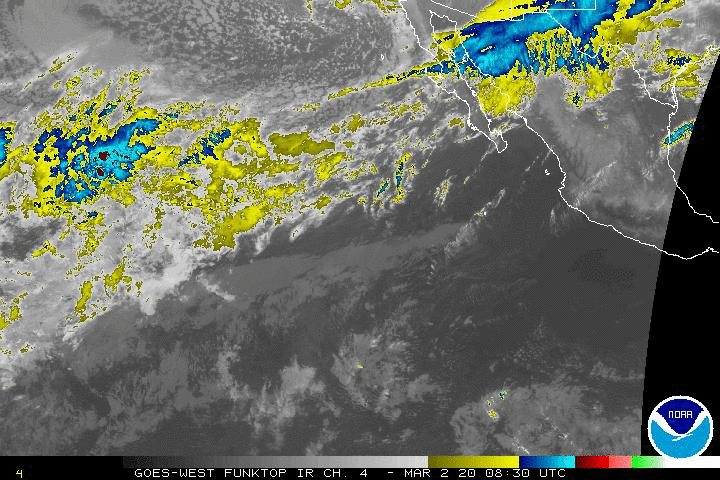
HA! Almost forgot the animated GIF
http://www.ssd.noaa.gov/goes/west/epac/ft-animated.gif
*
Music … internet radio is really our thing. The weather is just a hobby. We bring the sounds of Cabo San Lucas to the World, One Internet Connection at a time. http://www.livecaboradio.com/
Please give us a LIKE on our FB page: https://www.facebook.com/LiveCaboRadio/
And … do not forget the hurricane FB group where we talk about when S*** gets real, what to do, what not to do, and keep each other updated. In the files section there are a few good but still being perfected lists of things everyone should have on hand in the event of ANY emergency: Hurricanes, Earthquakes, Financial Hardship … if we’ve got any preppers following us, we’d love more advice! https://www.facebook.com/groups/727074667339978/
Some on cell phones may have difficulty getting to the files section which is here. https://www.facebook.com/groups/727074667339978/files/
One comment