
Afternoon update: It is starting to look like Estelle may not become a hurricane after all … currently located 695 miles from Cabo moving WNW at 12mph with max sustained winds at 65mph as she moves over cooler water. Darby is starting to give up hope. Disturbance #1 is down by Guatemala which is moving WNW away from land at about 10mph still shows a 70% chance of forming in the next 5 days. I guess we will know by the weekend for sure. Disturbance #2 is 750 miles from Acapulco and has been upgraded to 40% chance of formation over the next 5 days as it moves west at 10-15mph. I know some are watching #1 but as of this moment, #2 – according to the models show more of a chance of formation. Need more data. Posible manana In other news, Los Cabos up to La Paz lost internet, land lines, cell phones and banking for about 2 hours earlier today. Something about the fiber-optic line being severed. Again. ~end edit 3pm Cabo Time
Only four more days of what feels like cubicle life. Life in paradise … but in a small office nevertheless. Oh wait, you don’t care about my being stuck in an office dreaming of a mental health day (the beach) so let’s get to the weather!

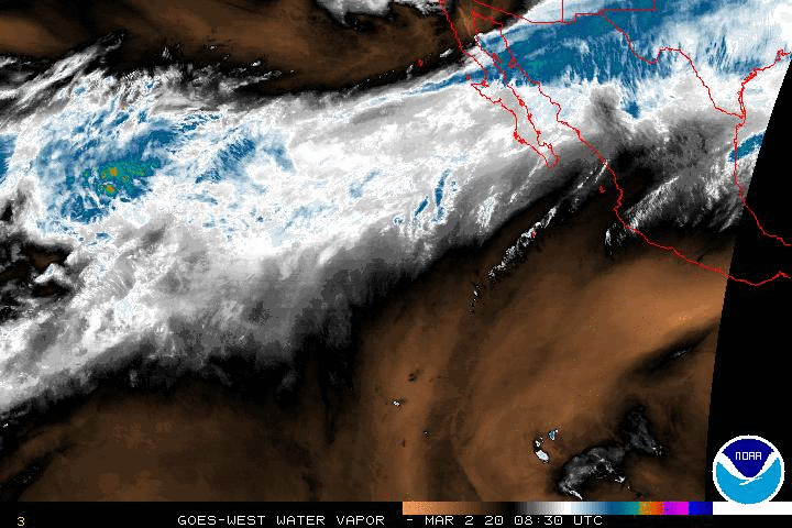
http://www.ssd.noaa.gov/goes/west/epac/wv-animated.gif
Estelle …

Let’s get a small refresher on computer models whilst I plagiarize myself.
Let’s take a moment and review computer models. There are more than you see in the image below but these are the primary ones used. As you can see, they do not agree where the storm will end up. (This really only matters, to me, if land it threatened which it is NOT)

So the experts take all of those models and create the images below to create forecast paths. If/when a storm gets closer, we’ll get into why we still need to pay attention even if we aren’t inside the forecast track.

From the NHC (CLICK ME) if you prefer a direct link
000
WTPZ31 KNHC 191440
TCPEP1

BULLETIN
TROPICAL STORM ESTELLE ADVISORY NUMBER  17
NWS NATIONAL HURRICANE CENTER MIAMI FL       EP062016
800 AM PDT TUE JUL 19 2016

...ESTELLE COULD STILL BECOME A HURRICANE BEFORE REACHING COOLER
WATERS...


SUMMARY OF 800 AM PDT...1500 UTC...INFORMATION
----------------------------------------------
LOCATION...18.8N 118.8W
ABOUT 640 MI...1030 KM WSW OF THE SOUTHERN TIP OF BAJA CALIFORNIA
MAXIMUM SUSTAINED WINDS...65 MPH...100 KM/H
PRESENT MOVEMENT...WNW OR 285 DEGREES AT 12 MPH...19 KM/H
MINIMUM CENTRAL PRESSURE...993 MB...29.33 INCHES


WATCHES AND WARNINGS
--------------------
There are no coastal watches or warnings in effect.


DISCUSSION AND 48-HOUR OUTLOOK
------------------------------
At 800 AM PDT (1500 UTC), the center of Tropical Storm Estelle was
located near latitude 18.8 North, longitude 118.8 West. Estelle is
moving toward the west-northwest near 12 mph (19 km/h).  A motion
toward the west or west-northwest with some increase in forward
speed is expected over the next couple of days.

Maximum sustained winds are near 65 mph (100 km/h) with higher
gusts.  Some strengthening is possible today or tonight, and
Estelle could still become a hurricane. Gradual weakening is
expected to begin on Wednesday.

Tropical-storm-force winds extend outward up to 160 miles (260 km)
from the center.

The estimated minimum central pressure is 993 mb (29.33 inches).


HAZARDS AFFECTING LAND
----------------------
None.


NEXT ADVISORY
-------------
Next complete advisory at 200 PM PDT.

$$
Forecaster Brown

Darby … Is totally tapping out. Weakness I tell ya! Darby has received his demotion back to Tropical Storm status, a strong one, with 70mph max sustained winds speeds. #Hawaii of course is grateful ❤️ Though they are in the 5-Day so … maybe a small reminder about forecast tracks 😊


I prefer wundergound because it is color coded … but the NHC is the official one

For the image below: Anywhere that is shaded all white is where the center of this system could end up in the next 3 days and potential days 4 and 5 are semi shaded. As you can see, they really cover themselves on where this system might end up! Many people breath in a sigh of relief when they see that land is not in the “Cone of Conern” but that doesn’t mean an area will not get some wind and rain if Darby has any muscle left, it just means that the professionals do not think the center of the storm will pass over land. When it comes to a hurricane or strong tropical storm especially if it calls for heavy rains, THAT, is when people near the coast need to pay attention. At this time, it doesn’t appear to be the case for #Hawaii. Let’s see what the NHC has to say (CLICK ME) for link to original source of text.
000
WTPZ35 KNHC 191438
TCPEP5

BULLETIN
TROPICAL STORM DARBY ADVISORY NUMBER  32
NWS NATIONAL HURRICANE CENTER MIAMI FL       EP052016
800 AM PDT TUE JUL 19 2016

...DARBY WEAKENS TO A TROPICAL STORM...


SUMMARY OF 800 AM PDT...1500 UTC...INFORMATION
----------------------------------------------
LOCATION...19.8N 135.4W
ABOUT 1280 MI...2060 KM E OF HILO HAWAII
MAXIMUM SUSTAINED WINDS...70 MPH...110 KM/H
PRESENT MOVEMENT...WNW OR 285 DEGREES AT 12 MPH...19 KM/H
MINIMUM CENTRAL PRESSURE...991 MB...29.27 INCHES


WATCHES AND WARNINGS
--------------------
There are no coastal watches or warnings in effect.


DISCUSSION AND 48-HOUR OUTLOOK
------------------------------
At 800 AM PDT (1500 UTC), the center of Tropical Storm Darby was
located near latitude 19.8 North, longitude 135.4 West. Darby is
moving toward the west-northwest near 12 mph (19 km/h).  A turn
toward the west is forecast to occur tonight, and this general
motion is expected to continue during the next few days.

Maximum sustained winds have decreased to near 70 mph (110 km/h)
with higher gusts.  Gradual weakening is forecast during the next
48 hours.

Tropical-storm-force winds extend outward up to 90 miles (150 km)
from the center.

The estimated minimum central pressure is 991 mb (29.27 inches).


HAZARDS AFFECTING LAND
----------------------
None.


NEXT ADVISORY
-------------
Next complete advisory at 200 PM PDT.

$$
Forecaster Roberts

10-day again in case we need reminders rain can happen at any time … or not.

Won’t speculate on the disturbances as this time. Long term forecast models do no agree on any level this morning.
~Jenn
Music … internet radio is really our thing. The weather is just a hobby. We bring the sounds of Cabo San Lucas to the World, One Internet Connection at a time. http://www.livecaboradio.com/
Please give us LIKE on our FB page: https://www.facebook.com/LiveCaboRadio/
And … do not forget the hurricane FB group where we talk about when S*** gets real, what to do, what not to do, and keep each other updated. In the files section there are a few good but still being perfected lists of things everyone should have on hand in the event of ANY emergency: Hurricanes, Earthquakes, Financial Hardship … if we’ve got any preppers following us, we’d love more advice! https://www.facebook.com/groups/727074667339978/
Some on cells phones may have difficulty getting to the files section which is here. https://www.facebook.com/groups/727074667339978/files/
One comment