

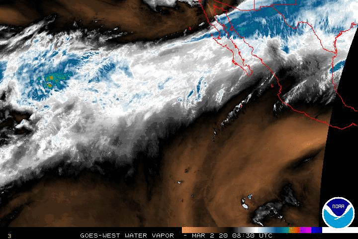
First, our own weather. It’s fab! Oh who am I kidding that is totally subjective plus the weather reports are all over the place. Yesterday for about an hour, it said we were 100% FOR SURE totally getting 15-20mph winds with 1.5-2 inches of rain in both Cabo and San Jose and then … it was changed back to the regularly scheduled program of 3-5% chance it might sprinkle. I see the same thing today except at least today’s satellite imaging shows water vapor, by I digress. I am personally over heated and cannot drink enough infused water which I now add a pinch of sea salt to and some local raw organic honey as the humidity is getting to me. All I know, is I totally believe the part of the official forecast that says HEAT WAVE.
EDITED TO ADD THIS IMAGE. Not 10 minutes ago (actually at 11:50 and it is now 12:20 Cabo time mst) … we were clear skies with 10% chance. Looks like today’s forecast will be just as wonky as yesterday.

Over in the Atlantic, there is an area of interest being monitored by the National Hurricane Center and looking at the 5 day it doesn’t seem likely one would bother with a weather report yet the are storm computer models that show this system, whatever it will be or not be, might travel across all of Mexico and end up on the Pacific. Not a very far fetched idea, actually.

Weather knows no bounds, right? Well, Danielle’s clouds spread out all over Mexico so why can’t this area of interest?

Looking at the image above from Wunderground, and remembering that each dot on the color coded lines equals 12 hour marks for the computer model simulations … it’s possible we might see a little rain in the next few days even if the 10-Day looks bright and sunny.
To quote myself out of shear laziness from This Blog Entry:
Computer Models. What are those things again? Well first, what is an “Invest” …
“An invest in meteorology (short for investigative area, alternatively written INVEST) is a designated area of disturbed weather that is being monitored for tropical cyclone development.” https://en.wikipedia.org/wiki/Invest_%28meteorology%29
So we’ve got an area of disturbance. Now what? Well, computer hurricane models that use mathematical equations try and figure out what the weather or in this case a storm, will do next. Each computer model has its strengths and its weaknesses and they rarely agree 100%. It helps to see them all in one screen shot. Using Invest 91e as an example, notice where the red “L” is? That is the current location of this system. Each different colored line is a path with time markers each of the 6 most widely used computer models think this system will go and each dot represents a twelve (12) hour period). These computer models will change their “minds” several times a day every day so it really is pointless to check them every 5 minutes (besides the fact that they aren’t updated more than a few times per day and double that is threat to land is possible).
It needs to be pointed out that every long term forecast site that puts those computer models in motion do not show this system crossing over Mexico and becoming a Tropical anything. In fact, I do not see it turning into anything but we know how the weather works – oh come on that right there is funny. We don’t! At least I don’t.
So let’s be weather nerds together and see what this thing does. Wow … I sure am getting wordy.

Have a great day! Go out and do something fun and rub it in my face. PICS PLEASE of your awesomeness at the beach!
~Jenn
Oh … I don’t know that I’ll stick around and continue to blog over at wunderground but if you missed it, this is my lame first blog. my-first-blog-is-such-a-lame-title I could use some advice on whether to continue over there …
http://www.ssd.noaa.gov/goes/east/watl/wv-animated.gif
http://www.ssd.noaa.gov/goes/west/epac/wv-animated.gif